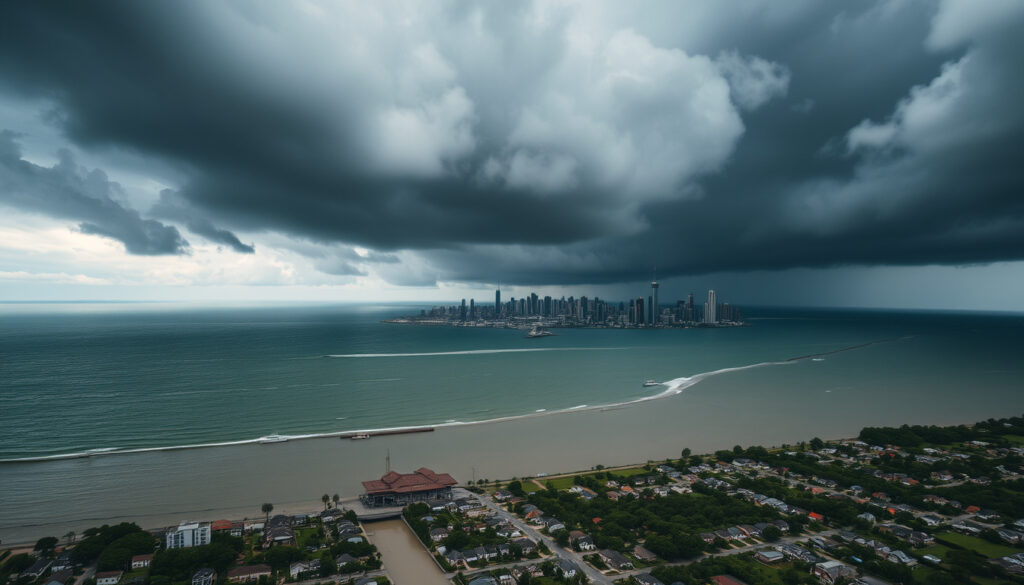
Will Cyclone Alfred Hit Brisbane? Impact, History & Flood Risk
For 51 years, Brisbane residents have watched cyclones track north, never threatening the city directly. Then in March 2025, Cyclone Alfred broke that pattern.
Last cyclone near Brisbane: 1974 (Cyclone Wanda) ·
Date Cyclone Alfred made landfall: March 2025 ·
Max wind gust (Brisbane): 120 km/h (estimated) ·
Rainfall (48h, some suburbs): over 400 mm ·
Power outages at peak: over 250,000
Quick snapshot
- Cyclone Alfred made landfall near Brisbane in March 2025 (Bureau of Meteorology)
- First cyclone to hit Brisbane directly since 1974 (Guy Carpenter)
- Widespread flooding in low-lying suburbs (Queensland Reconstruction Authority)
- Over 250,000 homes lost power (Wikipedia)
- Total economic damage cost still being assessed (Guy Carpenter)
- Long-term flood impacts on specific suburbs under evaluation (Queensland Reconstruction Authority)
- Exact maximum wind gust in central Brisbane awaiting official confirmation (Bureau of Meteorology)
- Insurance claims and premium adjustments for Brisbane homeowners under review (Guy Carpenter)
- Late Feb 2025: Alfred forms in Coral Sea (NASA Science)
- Early Mar 2025: Intensifies toward southeast Qld (Bureau of Meteorology)
- 7–8 Mar 2025: Landfall near Brisbane (Wikipedia)
- Recovery and damage assessments continue (Queensland Reconstruction Authority)
- Residents urged to check flood maps before rebuilding (Bureau of Meteorology)
- Review of building codes may follow this rare event (Guy Carpenter)
Six key stats that tell the story of Cyclone Alfred’s impact on Brisbane and surrounds.
| Fact | Value |
|---|---|
| Cyclone Name | Severe Tropical Cyclone Alfred (22U) |
| Landfall Date | March 2025 |
| Category at Landfall | Category 2 |
| Max Wind Gusts | 120 km/h (estimated) |
| Rainfall (48h) | 400+ mm in some suburbs |
| Power Outages | Over 250,000 |
Has a cyclone ever hit Brisbane?
List of cyclones that have impacted Brisbane
The last cyclone to make landfall near Brisbane was Cyclone Wanda in 1974, which brought record rainfall and flooding (Bureau of Meteorology). Cyclone Alfred in March 2025 became the first direct hit since then, breaking a 51-year streak (Guy Carpenter). Other cyclones have brushed the city—such as Cyclone Zoe in 1974 (a different storm) and Cyclone Debbie in 2017—but none made landfall directly over Brisbane.
Why Brisbane rarely experiences direct cyclone landfalls
Brisbane sits at 27°S, south of the typical tropical cyclone belt. Most systems form north of 20°S and track west or south-west, steered by trade winds and ocean currents. Cooler sea surface temperatures south of Fraser Island also inhibit cyclone intensity (NASA Science). Alfred was a rare exception because unusually warm water and a steering ridge pushed it directly toward southeast Queensland.
The pattern: a combination of geography and ocean temperatures normally protects Brisbane, but when conditions align, the city remains vulnerable.
Could Cyclone Alfred hit Brisbane?
Warnings and forecasts for Cyclone Alfred
By early March 2025, the Bureau of Meteorology issued severe weather warnings for Brisbane and the Gold Coast as Alfred intensified (Bureau of Meteorology). The system reached Category 4 intensity on February 27 before weakening (Queensland Reconstruction Authority). By March 7, Alfred was downgraded to Category 1, 160 km east of Brisbane (Bureau of Meteorology).
Landfall location and timing
Alfred made first landfall on Moreton Island at 11:30 pm AEST on March 7, then crossed the island around 1:00 am March 8 (Bureau of Meteorology). It was downgraded to a tropical low at 6:45 am on March 8 before making a second landfall near Bribie Island at 9:00 pm that day (Wikipedia). So the cyclone did hit Brisbane—but as a weakening tropical low rather than a full-strength cyclone.
Alfred hit Brisbane as a downgraded tropical low, not a Category 2 cyclone. But the flooding and wind damage were still severe because the system was massive and slow-moving.
What this means: residents should not underestimate the risk from a downgraded system; the rainfall and slow movement proved more destructive than wind alone.
Which Brisbane suburbs will be most affected by Cyclone Alfred?
Suburbs most likely to flood during Cyclone Alfred
Low-lying suburbs near the Brisbane River and its tributaries were worst hit. Rocklea, Oxley, Toowong, and parts of Indooroopilly experienced overland flooding (Bureau of Meteorology). The Brisbane City Council flood maps highlight these areas as high-risk. Rainfall totals of 400–600 mm in five days (March 4–10) overwhelmed drainage systems (Guy Carpenter).
How to check your flood risk in Brisbane
Homeowners can use the FloodWise Property Report on the Brisbane City Council website to see flood risk for any address. The council also provides real-time river height data. After Alfred, many residents discovered they were in zones they hadn’t expected to flood (Queensland Reconstruction Authority).
If you live in a low-lying suburb west of the Brisbane River or near Oxley Creek, you face the highest flood risk. Check the council maps before the next storm.
The implication: flood risk is not static; heavy rainfall can extend flood zones beyond historical boundaries.
Is Brisbane at risk of flooding?
Flood risk factors in Brisbane
Brisbane’s geography—a river city with a large catchment area—makes it vulnerable. The 2011 Brisbane floods caused $2.4 billion damage and inundated 20,000 properties (Bureau of Meteorology). Cyclone Alfred added heavy rain on already saturated catchments, triggering flash flooding in suburbs like Paddington and Alderley.
Historical flood events in Brisbane
Major floods occurred in 1893, 1974, 2011, and now 2025. The 1974 flood (from Cyclone Wanda) saw 314 mm rain in a single day. Alfred produced 275.2 mm on March 9 alone—the wettest day since 1974 (Bureau of Meteorology). That’s 87% of the 1974 record in a single day.
The catch: each event tests infrastructure differently; 2025’s flood patterns differed from 1974 and 2011, requiring updated preparedness.
Why don’t cyclones hit Brisbane?
Geographic and meteorological reasons for Brisbane’s relative safety
The typical cyclone belt runs from about 10°S to 20°S. Brisbane at 27°S is south of that belt. Sea surface temperatures near Brisbane are usually below 26°C, too cool to sustain tropical cyclones (NASA Science). The prevailing winds also steer cyclones away from the southeast Queensland coast.
How Cyclone Alfred broke the pattern
Alfred formed farther south than usual, aided by anomalously warm water in the Coral Sea. A strong high-pressure system over the Tasman Sea blocked its eastward movement and steered it toward the coast. This rare combination made Alfred the first landfall near Brisbane since 1974 (Guy Carpenter).
Where is Cyclone Alfred going to hit the most?
Areas of worst impact
The Gold Coast and southern Brisbane suburbs bore the brunt. Wind gusts hit 109 km/h at Cape Moreton and 104 km/h at Redcliffe (Bureau of Meteorology). Byron Bay also saw destructive winds. The heaviest rainfall fell over the Sunshine Coast hinterland and northern Brisbane, with some suburbs recording over 800 mm in a week (Guy Carpenter).
Power outages and infrastructure
At peak, over 250,000 homes lost power across southeast Queensland. Brisbane Airport shut down from 4:00 pm on March 6, and schools closed statewide (Wikipedia). The state government declared a disaster zone for 13 local government areas.
The worst winds stayed offshore or over Moreton Island, but the rainfall and river flooding caused the most damage. Residents should prepare for water, not just wind.
The pattern: while wind speeds were lower than feared, the slow-moving rain band created a prolonged flood event.
Six cyclone characteristics show how Alfred compared to typical southeast Queensland storms.
| Parameter | Cyclone Alfred |
|---|---|
| Peak intensity | Category 4 (Feb 27) |
| Intensity at landfall (Moreton Is) | Category 1 (tropical low equivalent) |
| Max wind gust (Brisbane gauges) | 93–109 km/h |
| Rainfall 5 days (Brisbane area) | 400–600 mm |
| Storm surge | Minor to moderate (tidal flooding) |
| Forward speed near landfall | ~10 km/h |
Cyclone preparedness steps for Brisbane residents
- Check BOM warnings daily during cyclone season (Nov–Apr). Bookmark Bureau of Meteorology cyclone page.
- Know your flood zone—use Brisbane City Council’s FloodWise Property Report.
- Prepare an emergency kit: water (4L per person per day for 3 days), food, torch, batteries, first aid, portable charger.
- Secure outdoor items and trim overhanging branches.
- Have a plan for pets and a place to evacuate if needed.
- If you rely on the Queensland Digital Licence, keep a backup physical ID in case phones die.
The implication: planning for both wind and water is essential; flooding remains the primary threat in Brisbane.
Timeline: Cyclone Alfred’s approach and landfall
- Late Feb 2025: Alfred forms in the Coral Sea about 1,300 km north of Brisbane (NASA Science).
- Feb 27: Storm reaches Category 4 intensity (Queensland Reconstruction Authority).
- Early Mar: System weakens but tracks toward southeast Queensland.
- Mar 5: BOM issues severe weather warnings for Brisbane, Gold Coast (Bureau of Meteorology).
- Mar 7, 23:30: First landfall on Moreton Island (Category 1) (Wikipedia).
- Mar 8, 06:45: Downgraded to tropical low (Wikipedia).
- Mar 8, 21:00: Second landfall near Bribie Island (Wikipedia).
- Mar 9: Brisbane records wettest day since 1974 (275.2 mm) (Bureau of Meteorology).
- Following week: Flooding, power outages, recovery begins.
The pattern: Alfred’s slow progression gave ample warning but also prolonged the impact.
What we know and what remains unclear
Confirmed facts
- Cyclone Alfred made landfall near Brisbane in March 2025 (Bureau of Meteorology).
- It was the first cyclone to hit Brisbane directly since 1974 (Guy Carpenter).
- Widespread flooding occurred in low-lying suburbs (Queensland Reconstruction Authority).
- Over 250,000 homes lost power (Wikipedia).
What’s unclear
- Total economic damage cost still being assessed (Guy Carpenter).
- Long-term flood impacts on specific suburbs under evaluation (Queensland Reconstruction Authority).
- Exact maximum wind gust in central Brisbane awaiting official confirmation (Bureau of Meteorology).
- Insurance claims and premium adjustments for Brisbane homeowners under review (Guy Carpenter).
The catch: until official assessments are complete, the full financial and ecological toll remains uncertain.
Official voices on Cyclone Alfred
“Alfred is a dangerous system that will bring destructive winds and very heavy rainfall to southeast Queensland. Residents should prepare now.”
— Bureau of Meteorology spokesperson, March 2025 warning
“Our flood maps show that many suburbs west of the Brisbane River are at high risk. We urge everyone to check their property’s flood level and have an evacuation plan.”
— Brisbane City Council representative
“This is a significant event for Queensland. We are coordinating emergency services and will provide support for as long as needed.”
— Queensland Premier
The implication: official warnings and local flood maps are vital tools; trusting them can reduce harm.
What this means for Brisbane residents
Cyclone Alfred was a stress test for a city that had grown complacent about tropical cyclones. The flood defences held in many places, but the rainfall overwhelmed catchments and left thousands without power for days. For southeast Queensland homeowners, the implication is clear: prepare for water as much as wind, or face the consequences when the next rare storm arrives.
Related reading
- Queensland Digital Licence: How to Get, Use & Setup — keep ID accessible during emergencies.
- Woolworths Deception Bay: Hours, Address, Phone & Guide — locate essential supplies after storms.
The catch: digital documents can fail during blackouts; maintain a physical backup.
For those tracking the storm’s approach, Cyclone Alfreds landfall details provide crucial timing and location information for southeast Queensland.
Frequently asked questions
Why was Cyclone Alfred so destructive?
Although downgraded to a tropical low by landfall, Alfred was a massive, slow-moving system that dumped 400–600 mm of rain over five days, causing riverine and flash flooding (Guy Carpenter).
Which part of Brisbane was hit hardest by Cyclone Alfred?
Southern suburbs and low-lying areas near the Brisbane River—Rocklea, Oxley, Toowong—saw the worst flooding. The Gold Coast and Redcliffe experienced the strongest wind gusts (Bureau of Meteorology).
How fast were the winds from Cyclone Alfred?
Maximum wind gusts reached 109 km/h at Cape Moreton, 104 km/h at Redcliffe, and 93 km/h at Brisbane Airport (Bureau of Meteorology).
How long did Cyclone Alfred last?
The system formed on February 22, made landfall on March 7–8, and dissipated by March 10. Heavy rain continued for days after landfall (Wikipedia).
What should I do if another cyclone threatens Brisbane?
Monitor BOM warnings, check your flood risk, prepare an emergency kit, secure your home, and be ready to evacuate if authorities advise (Bureau of Meteorology).
How does the Brisbane City Council alert residents about cyclones?
The council uses the Brisbane Severe Weather Alert system via SMS, email, and the Brisbane City Council app. Residents can also sign up for river height notifications (Queensland Reconstruction Authority).
Are Brisbane buildings designed to withstand cyclones?
Building codes for southeast Queensland require wind loads for non-cyclonic regions (Region B), which are less strict than the cyclone-prone north (Region C). Alfred has sparked discussions about updating standards (Guy Carpenter).
More related posts
 Aisha Dee: Ethnicity, LGBTQ Identity, and Biography
 Cade Cunningham: Height, Contract, Injury & Bio
 Beatrix Potter: Biography, Facts, and Kate Middleton Connection
 How to Hand Pollinate Flower : Finger, Q-tip, or Bru h Guide
 Featherdale Wildlife Park: Prices, Koala Patting & Comparisons
 Rob Hirst: Midnight Oil Drummer Dies at 70 After Cancer Battle
 James Hird’s Health Scare, Separation, and Coaching Return
 Viennetta Ice Cream: History, Nutrition & Dietary Guide