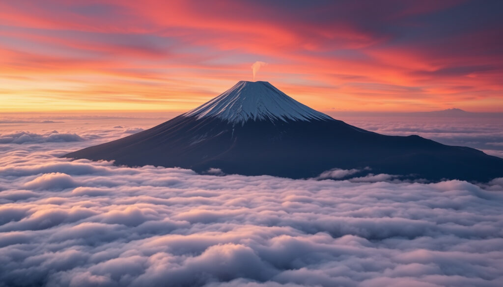
Mt. Fuji: Active Volcano, Location, Facts & Eruption Risk
There’s something about Mount Fuji that draws people in—whether it’s the perfectly symmetrical cone rising above the clouds, the promise of a sunrise from the summit, or the quiet tension of knowing it’s still an active volcano. This guide brings together the latest monitoring data, practical travel advice, and the key facts you need to know, whether you’re planning a climb or simply curious about Japan’s most famous peak.
Height: 3,776 meters ·
Last eruption: 1707–1708 ·
Location: Honshu, Japan ·
Status: Active (low risk) ·
UNESCO status: World Heritage Site (2013)
Quick snapshot
- Mt. Fuji is an active stratovolcano with last eruption in 1707 (Official Mt. Fuji Climbing site (government-operated)).
- It is monitored by the Japan Meteorological Agency (Japan Meteorological Agency (national weather authority)).
- Fujinomiya is the closest major city to the summit (Japan Guide (travel guide)).
- Exact date or magnitude of the next eruption.
- Effectiveness of current evacuation plans for Tokyo if a major eruption occurs.
- Precise boundaries of private ownership on the summit area.
- Last eruption: 1707 (Hoei eruption). Ash reached Edo, now Tokyo.
- UNESCO listing: 2013.
- 2023: Government updated evacuation plan for Tokyo ashfall scenario.
- 2026 climbing season opens July 10 for Fujinomiya and Gotemba trails (Official Mt. Fuji Climbing website).
- No current volcanic warnings; alert level remains low (Japan Meteorological Agency).
- Tokyo ashfall simulation and evacuation drills continue. (Official Mt. Fuji Climbing website)
Six key facts at a glance, covering height in imperial units, eruption records, and climbing logistics.
| Fact | Value |
|---|---|
| Height in feet | 12,389 ft |
| First recorded eruption | 781 AD |
| Last eruption year | 1707 (Hoei eruption) |
| Climbing season | July to early September |
| Number of climbing trails | Four main routes |
| UNESCO listing year | 2013 |
Is Mt. Fuji still active?
Yes, Mt. Fuji is an active stratovolcano, though its last eruption was in 1707–1708. The Official Mt. Fuji Climbing website (managed by Shizuoka and Yamanashi prefectures) confirms it remains active, and the Smithsonian Institution’s Global Volcanism Program (volcano database) currently lists Fujisan as non-eruptive in the short term. The Japan Meteorological Agency (national volcanic monitoring authority) shows no active warnings, and the alert level is set to 1 (normal).
For climbers and residents, the low alert level means no immediate danger, but the volcano’s active status requires constant vigilance—especially for the millions living in the Tokyo metro area.
The implication: Volcanic activity is monitored around the clock, and the absence of warnings does not mean the risk is zero. It means the current conditions are normal for an active volcano.
Where is Mount Fuji exactly located?
Mt. Fuji sits on Honshu island, straddling the border between Shizuoka and Yamanashi prefectures. Its coordinates are 35.3606° N, 138.7275° E. On clear days, it is visible from Tokyo, roughly 100 kilometers to the west. The mountain is part of the Fuji volcanic belt and lies within the Fuji-Hakone-Izu National Park.
Three key geographic facts:
- Distance from Tokyo: about 100 km west-southwest.
- Nearest major city: Fujinomiya (Shizuoka) on the south side, approximately 30 km from the summit.
- Surrounding attractions: Fuji Five Lakes, Oshino Hakkai village, and the Fujisan Hongu Sengen Taisha shrine.
The catch: Its location makes it both a national symbol and a hazard—close enough to Tokyo that a major eruption could disrupt the lives of tens of millions.
Which city is closest to Mount Fuji?
Fujinomiya, in Shizuoka Prefecture, is the closest major city to the summit, about 30 kilometers south. It’s a common base for climbers using the Fujinomiya Trail. On the north side, Fujiyoshida in Yamanashi Prefecture is the gateway for the Yoshida Trail. Both cities offer accommodation, transport links, and climbing services.
Comparison of the two gateway cities shows different trade-offs for travel time and trail difficulty.
| City | Distance to summit | Main trail | Travel time from Tokyo |
|---|---|---|---|
| Fujinomiya | ~30 km | Fujinomiya Trail | ~2.5 hours by bus |
| Fujiyoshida | ~40 km | Yoshida Trail | ~2 hours by train |
The trade-off: Fujinomiya offers the shortest, steepest climb, while Fujiyoshida provides a more gradual ascent and is easier to reach from Tokyo.
What are 5 interesting facts about Mount Fuji?
- It is Japan’s tallest peak at 3,776 meters (12,389 feet).
- It is a sacred mountain in both Shinto and Buddhism, considered one of the “Three Holy Mountains.”
- It has three active volcanic craters at the summit.
- It is surrounded by the Fuji Five Lakes region, a popular resort area.
- It was added to the UNESCO World Heritage list in 2013 as a cultural site.
What this means: Mt. Fuji is not just a geographic landmark—it’s a deeply woven part of Japan’s spiritual and cultural identity, with a history of eruptions that have shaped both the landscape and the nation’s preparedness.
Will Tokyo be affected if Mt. Fuji erupts?
Yes, a major eruption could send ashfall to Tokyo and the entire Kanto region. During the 1707 Hoei eruption, ash fell as far as Edo (now Tokyo). The Japanese government has simulated evacuation scenarios, and in 2023 it updated its ashfall contingency plan. The Japan Meteorological Agency (volcanic risk authority) continues to monitor the volcano closely, but the risk remains low.
For Tokyo’s 37 million residents, the threat is real but not imminent. The city’s infrastructure—transport, power, water—could be severely disrupted by ashfall, even from a moderate eruption.
The pattern: Historical eruptions show that Mt. Fuji can stay quiet for centuries and then erupt with little warning. The government’s updated plans are a prudent step, but their effectiveness under real conditions remains untested.
Who owns Mt. Fuji?
From the 8th station (about 3,360 meters) to the summit, the land is privately owned by the Fujisan Hongu Sengen Taisha shrine (Shinto shrine authority). The rest of the mountain is public land managed by the Japanese government. This ownership arrangement dates back to 1609, when the shrine was granted the summit area. The shrine’s ownership is a unique blend of religious and property law.
The catch: The exact boundaries of private ownership are not fully mapped, which occasionally creates confusion for maintenance and access rights.
How long is a day trip from Tokyo to Mount Fuji?
A day trip from Tokyo to Mt. Fuji is feasible but tight. The bus from Shinjuku to the Fuji Subaru Line 5th Station takes about 2.5 hours. The train to Kawaguchiko Station takes about 2 hours, then a bus to the 5th Station adds another hour. Most tour operators schedule 12–14 hour round trips, including time at the 5th Station and a short hike. The Japan National Tourism Organization (JNTO) (official tourism body) recommends a two-day trip with an overnight hut stay for those who want to reach the summit.
The trade-off: A day trip lets you see the mountain and experience the 5th Station, but if you want to climb to the summit, you need at least two days—and a reservation at a mountain hut.
Timeline of Mt. Fuji’s eruption history and modern preparedness
- 781 AD – First recorded eruption.
- 1707 – Last confirmed eruption (Hoei eruption). Ashfall reached Edo (Tokyo).
- 2013 – Designated UNESCO World Heritage Site.
- 2023 – Japanese government updates evacuation plan for Tokyo ashfall scenario.
Why this timeline matters: The gap between the last eruption and today is 317 years—a long pause by human standards, but geologically short. The government’s 2023 update shows that authorities are actively preparing for an event that could happen at any time.
Specifications of Mt. Fuji
Six key specs that define the mountain’s physical dimensions, volcanic history, and climbing infrastructure.
| Specification | Value |
|---|---|
| Height | 3,776 m (12,389 ft) |
| Type | Stratovolcano |
| Last eruption | 1707 (Hoei) |
| Climbing season | July 10 – September 10 (official) |
| Number of trails | 4 main routes |
| UNESCO listing | 2013 (Cultural) |
| Coordinates | 35.3606° N, 138.7275° E |
| Topographic prominence | 3,776 m |
| First ascent | 663 AD (by a monk) |
| Current alert level | 1 (normal) |
The pattern: These numbers show a mountain that is tall, active, and well-studied, but the long gap between eruptions means that many of its hazards are poorly understood by the general public.
Confirmed facts
- Mt. Fuji is an active volcano with last eruption in 1707.
- It is monitored by the Japan Meteorological Agency.
- Fujinomiya is the closest city to the summit.
- Climbing season is July to early September.
- UNESCO World Heritage Site since 2013.
What’s unclear
- Exact date or magnitude of the next eruption.
- Effectiveness of current evacuation plans for Tokyo if a major eruption occurs.
- Precise boundaries of private ownership on the summit.
- How much ashfall would actually reach central Tokyo in a worst-case scenario.
Expert perspectives on Mt. Fuji’s current state
“The current volcanic alert level is 1, indicating normal conditions. We continue to monitor seismic activity and ground deformation 24/7.”
— Japan Meteorological Agency spokesperson (volcanic monitoring authority)
“Our sediment control facilities are designed to handle mudflows and debris from a moderate eruption. We run annual drills with local communities.”
— Volcanic Sabo Office official (sediment control authority)
“The summit area has been owned by our shrine since 1609. It’s a sacred space, not just a tourist attraction. We work with the government to manage access.”
— Fujisan Hongu Sengen Taisha shrine representative (religious custodians)
Why these voices matter: The three perspectives—monitoring, infrastructure, and spiritual ownership—show that Mt. Fuji is managed by a unique mix of scientific, engineering, and religious institutions, each with a stake in its future.
Summary
For the millions of Tokyo residents, the choice is clear: stay informed through official channels like the Japan Meteorological Agency, support continued investment in volcanic monitoring and evacuation planning, or risk being caught off guard by a natural phenomenon that has remained quiet for over three centuries but could awaken at any time.
jrailpass.com, samuraicarjapanjdm.jp, fujisan-climb.jp, youtube.com, fujimountainguides.com, youtube.com, travelfujinomiya.com
The mountain’s status as an active volcano is well-documented, and Mount Fujis volcanic activity offers further insights into its eruption patterns.
Frequently asked questions
What is the elevation of Mt. Fuji?
3,776 meters (12,389 feet).
How often has Mt. Fuji erupted over the last 500 years?
Only once—the 1707 Hoei eruption. Before that, there were several eruptions in the 800s and 1000s, but the volcano has been quiet for over 300 years.
Can beginners climb Mt. Fuji?
Yes, the Yoshida Trail is the most popular for beginners, but it’s still a strenuous hike. The Japan National Tourism Organization (official travel guide) recommends a two-day trip with an overnight stay at a mountain hut.
How far is Mt. Fuji from Tokyo by car?
About 100 km west of Tokyo. Driving takes roughly 1.5 to 2 hours without traffic, but parking at the 5th Station is limited and can be crowded during peak season.
Is Mt. Fuji part of the Ring of Fire?
Yes, it lies on the Pacific Ring of Fire, a zone of intense volcanic and seismic activity. Japan sits on the convergence of several tectonic plates.
What is the best month to see Mt. Fuji clearly?
November to February tends to offer the clearest views because the air is drier and less hazy. Summer months often have clouds obscuring the peak.
Are there any restrictions on climbing Mt. Fuji?
Yes. Trailhead gates are closed from 2pm to 3am except for hikers with mountain hut reservations. Off-season climbing (October to June) is strongly discouraged due to extreme weather conditions.
Related reading
- Cradle Mountain Tasmania: Worth Visiting? Complete Guide – Another iconic mountain destination with hiking and safety tips.
- Is Sri Lanka Safe to Visit? 2025 Travel Guide & Country Overview – A broader travel safety guide for adventurous travelers.
More related posts
 Marina Prior: Biography, Age, and Les Mis Role
 Harry Richardson: From Poldark to The Gilded Age — Career, Roles & Biography
 Denham Hitchcock: Age, Wife, Father, and Career | Biography
 Riz Ahmed: Biography, Oscar Win, Films, and Upcoming Projects
 Stanley Tucci: Health, Family, Age Gap, Italian Heritage
 Roger Climpson, Veteran TV News Anchor, Dies at 93
 Takeru Satoh: Biography, Glass Heart, 2025 Projects
 NRMA Roadside Assistance Number: 13 11 22 | 24/7 NSW/ACT